Common Meadow

From the Town Bridge in Leatherhead a path leads down the Mole riverside, under some attractive railway bridges and into Common Meadow, part of the original floodplain which was once cut for hay and grazed by cattle, and is now (thanks to the Leatherhead and District Countryside Protection Society) common land.

This walk is described in the Leatherhead Riverside Walk Leaflet (as ‘Walk One’), so I will only talk about the things that stood out for me.

The main thing that struck me were the two railway bridges over the mole, the first one particularly ornate. This was built when the railway between Leatherhead and Dorking was laid by the London, Brighton and South Coast Railway in the 1860s. According to the Riverside Walk leaflet, the elaborate design of the bridge was at the insistence of Thomas Grissell, then owner of Norbury Park, as a condition of allowing the railway through his land. He also required the portals of the Mickleham tunnel to have architectural treatment and that a station be built at Westhumble at which he had the right to stop any train!

20151126_131355.jpg

Looking downstream to the railway bridge(s)

20151126_132048

Past the railway bridges, the open space of Common Meadow

20151126_134215

At the other end of Common Meadow, the path ends. Such a shame!

Posted in Bridge, History, Leatherhead | Leave a comment

Emlyn Stream

Time to break the journey with a brief interlude of poetry and names and a mystery!

In olden days the River Mole was known as the Emlyn Stream (or Emel or Aemen) which according to various experts might mean misty stream or mill stream. Both of these theories make sense (river mist is not unusual, and the Mole had lots of watermills in its day). Both theories are less fun than the (probably fake) origin tale for the name Mole – that the river in dry summers went underground like a mole, tunnelling through the Surrey downs.

But I recently came across another possible origin for the name Emlyn Stream, in a poem about the Mole written in 1839 by a young lady called Mary Drinkwater Bethune.  Mary’s poem tells of Emlyn, a maiden at Arthur’s court, beautiful but cold, who disdained the vows of her suitor Pepin, and was transformed by Merlin into a gliding stream:

“Old legends tell, that erst in Arthur’s court
Emlyn was peerless deemed; and, cold as fair,
The scornful nymph disdained young Pepin’s vows ;
Rousing the wrath of Merlin, who transformed
The hapless maiden to a gliding stream:
But Pepin shared her doom, and, constant still.
Pursues his wayward love, who shrinking flies,
As Arethusa in Sicilian vales
Fled from the bold Alpheus.—Others deem,
That, banished for some crime from fairy land,
The mournful stream does penance here on earth,
In sad discoloured garb, all pale and wan;
And often tries the much-loved path of home.
As oft repulsed, and issues forth again
In many a tearful well and plaintive spring.”

I’ve never come across this legend before, nor heard of Emlyn and Pepin at Arthur’s court, so I wonder whether Mary made up the tale, or whether she found it somewhere else. Any input welcome!

river-mole


Notes on Names:

In A Topographical History of Surrey, Volume 1 (published in 1841) the etymology of the Mole is discussed as follows: “This river, which was anciently called the Emele, Emlyn and
Emley stream, gives name to the Hundred of Emley Bridge, or Amele-brige, as it is spelt in the Domesday Book, and through the whole of which it flows. The etymology of that name may be referred to the British word Melin, or Y-Melyn, the mill; and thus indicate the Mill river;—an opinion which receives corroboration from the Domesday record, wherein nearly twenty places are mentioned as possessing mills, which, from their respective localities, must have been situated, either on this stream, or its immediate auxiliary
branches- Even its present appellation, the Mole, by which it was also known prior to the Conquest will admit of a similar origin; the Latin Mola signifying a mill, and thus perfectly coinciding with the more ancient phrase. These inferences seem far more reasonable,
than that the river should derive its name from the vague comparison of “betaking itself to subterraneous passages like a Mole” — which Camden suggested, and later topographers have given credence to.”

The older name of the Mole is thought to be the basis for the name of the local district, Elmbridge. The entry for Elmbridge in A Dictionary of British Place Names by David Mills is as follows:

Elmbridge (district) Surrey. Amelebrige 1086 (db). ‘Bridge over the River Emel‘. A revival of an old hundred-name. Pre-Celtic river-name (of uncertain meaning, an old name for the River Mole for which see MOLESEY) + OE. brycg.

The Wikipedia entry for the River Mole suggests that the name is probably derived from the Old English word æmen meaning misty or causing mists.

Mary’s Poem

The River Mole, or Emlyn Stream was published in 1839, a book consisting of a rather long poem written by “M.D.B.” and notes by William Cotton. “M.D.B.” was Mary Uniacke (writing under her maiden name Mary Drinkwater Bethune). A note on Wikipedia identifies Mary as the daughter of the English army officer and military historian Colonel John Drinkwater Bethune, who lived at Thorncliffe Manor, Leatherhead. The book was privately printed  in aid of the fund for building National Schools at Lethrede (Leatherhead).


Posted in History, Poetry | Tagged , | 1 Comment

Stoke D’Abernon

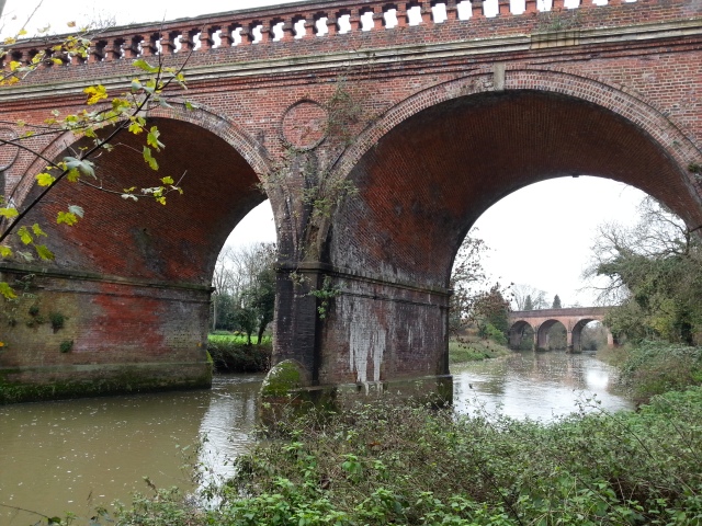
As the Mole continues out of Leatherhead, it passes under the M25 and enters the village of Stoke D’Abernon near the parish church of St Mary’s. According to the church history webpage, the original church, substantial portions of which survive on the south side, was built in the late 7th or early 8th century and so belongs with the scatter of south-eastern churches that immediately followed the introduction of Christianity to southern England in 597 by St Augustine.

20151010_125056

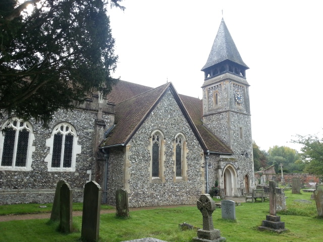
St Mary’s Church, Stoke D’Abernon

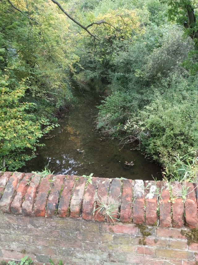
Next to the Church is the old manor house, which currently hosts an independent Prep School, Parkside School, which explains the flotation rings on the nearby bank of the Mole.

20151010_124938

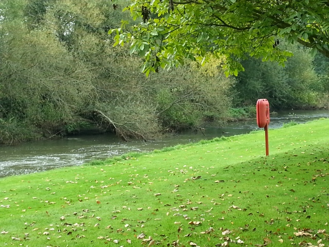
The Mole running by Parkside School and St Mary’s Church

Downside Mill

From St Mary’s church, the Mole meanders across the fields, skirting the Chelsea FC Training Ground, passing under the London – Guildford railway, arriving at the site of Downside Mill. According to the Surrey Industrial History Group, a mill is known to have existed on the site from as early as 1331 and in the eighteenth century it operated both as a corn and a paper mill prior to becoming an iron Mill.

There is a fascinating section of T.E.C Walker’s history of Cobham [1], about an agreement made in 1565 between Thomas Lyfeild Esq. of Stoke d’Abernon and Francis his wife, and Thomas à Down of Cobham, governing the stretch of the river between Lyfeild’s home at the Stoke D’Abernon manor house next to St. Mary’s Church, and the mill belonging to Thomas à Down:

“It was stated that Down’s ancestors owned a mill called Down Mill, now decayed. The “Emlin Streame” (River Mole) had always and ought to be wholly without stoppage by the lords of the manor of Stoke, and to have its direct course from the manor place of Stoke by the demesne lands of the said manor to an ancient and old wharf (or “stopp”) near to the said mill, and from the said wharf to the said mill. It was now agreed that it should be lawful for à Down to make and repair as often as need be the said mill in the place or near abouts where the same mill of late, and also in ancient times, had stood. Also the lords of Stoke (owners of the riverside land between the seat of the manor and the said old wharf called the great wharf that did enforce the said river to the said mill) should not divert the water or break the banks, and they should allow à Down to stop up any breaches which might accidentally occur, à Down might also erect, repair, fasten, and affix the said wharf unto the lands and meadow called the great meadow, and to now make the same wharf as it had been and made before this time. Also à Down and all persons coming to the mill should have access by a convenient footway leading from Stokestreat over the field called Westfeild and so over the field called the mead Feild and the mead called the great mede and so over the said water called Emlyn stream unto the mill. à Down should twice in the summer time, when he should be required, stop or shut up all the floodgates, sluices, belonging to the said mill and the wharf for the space of three hours at a time so that Lyfeild might take the fish in the same river. “

Nowadays, some of the mill buildings are still present, and have been converted to offices and an auction house. The waterworks by the mill are heavily overgrown now, as can be seen below.

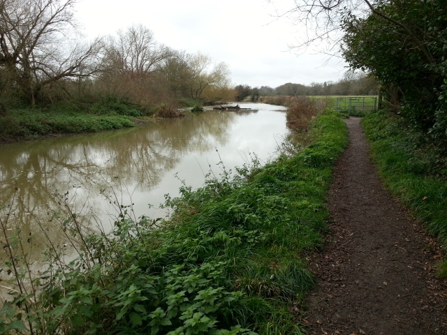
It looks like the Mole splits into two parts at Downside Mill. The two waterways flow in parallel for a while, to the right of the bridleway which runs from Downside Mill to the footbridge at River Lane. But then the major stream heads off across the fields in a loop towards the footbridge at River Lane, and the other smaller water passes under the bridleway and rejoins the main river later on in Cobham.

20151010_115849

The bigger waterway wanders across the fields from Downside Mill…

20151010_115728

…while the smaller part passes under the bridleway and rejoins the main river later on.

Ash Ford and Cobham Cemetery

“An ancient bridle way crosses the River Mole at Ash Ford on the parish boundary between Cobham and Stoke, thus linking the two Conservation Areas of the Tilt and Downside. The ford was only safe to those on foot when the river is low. The present footbridge (apparently the first bridge of any sort on this site) was opened at Easter 1994.” [2]

20151010_114908

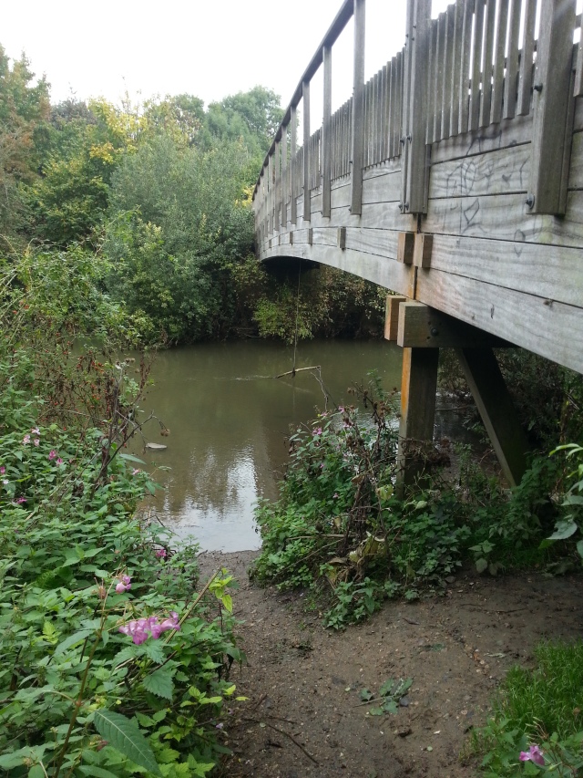
Ash Ford Bridge, River Lane, Cobham

There was at some time a mill near Ash Ford, according to T.E.C. Walker’s history of Cobham [1], being one of the three Cobham Mills mentioned in the Domesday Book: Downside Mill, Ashford Mill, and Cobham Mill. Walker says: “Cobham’s three mills were built fairly close together, since the gradient of the Mole is at its steepest near Downside mill, where in a bare half-mile the river falls about seven feet, from 80 feet to 73 feet above sea-level. If this half-mile is doubled Ash Ford is reached, and the fall for the mile is 11 or 12 feet, compared with the average fall of 16.5 inches a mile of the Thames.” The Mill at Ash Ford had apparently ceased operation by 1598, and Walker suggests that it might be connected with the land known as Mill field and Mill meadow which the tithe map of 1845 shows on the site of Cobham cemetery.

Downriver from the Ash Ford Bridge, the Mole flows on into the centre of Cobham, skirting Cobham Cemetry.

20151010_114657

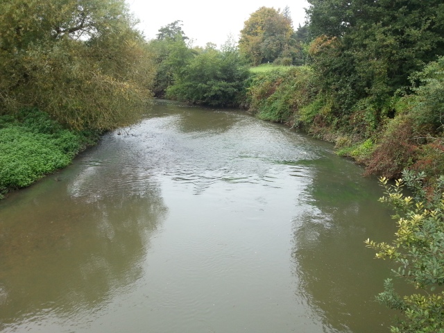
The view down-river from Ash Ford Bridge. Cobham Cemetery is on the right bank.


Notes:

[1] The River Mole: Its Mills, Fisheries and Bridges: a chapter in  Cobham: Manorial History, by T. E. C. Walker, F.S.A p. 59 onwards.

[2] Ash Ford Bridge page at Elmbridge online.

Posted in Bridge, Cobham, Downside, Mill, Stoke D'Abernon | Tagged | Leave a comment

Cobham Mill

As the Mole comes into Cobham it runs alongside the main road, the A245, often flooding it during the winter. Cobham Mill is located on this section of the river.

20150913_150159

The Domesday Book records three mills in Cobham in 1086:

CERTESYG Abbatia ten COVENHA. IN AMELEBRIGE HUND …….III. molini de. XIII fol 7 III denar …[1]

or

In ELMBRIDGE Hundred Chertsey Abbey holds COBHAM itself ……. 3 mill at 13s 4d

Although there is no evidence, it is likely that one of the three mills was this one (the other two mills being upstream at Ash Ford on Cobham Tilt and at Downside). The earliest known reference to a mill at the site of the present Cobham Mill is dated 1534 when it was owned, together with the Manor of Cobham, by the Abbey of Chertsey. Since then, the mill has been rebuilt and changed hands many times, until its use as a mill came to an end in 1928. It was then used for a while for grain storage  but eventually fell into disuse and disrepair. It was restored in the early 1990s by the Cobham Mill Preservation Trust, and is opened to the public once a month. [2]

When we visited the mill it was in operation (as it usually is when the mill is open) and grinding flour. We were each given a little bag of the flour, and enjoyed the tour (and the tea!) we were given. Here’s a video of the mill in action:


If you visit the mill be sure to have a look at the bit of the river just upstream where a number of weirs and routes for the water to flow have been made, presumably to allow the mill to function (and the river to avoid flooding) in a wide variety of water conditions. Here is a picture of the river coming into this network of streams and ponds, with the road behind:


River Mole coming into Cobham Mill

River Mole coming into Cobham Mill

Downstream from the mill, the mole runs through an area known as Riverhill which has recently been restored by the Cobham Conservation and Heritage Trust. They put up a nice sign with an indication of the wildlife we might see. Plants: Sneezewort, Cuckoo flower, Common Reed, Greater Dodder and meadow buttercup. Animals: Pipistrelle bats, Daubenton’s bats, various insects and waterbirds, plus kingfishers and herons (we saw about 8 herons sitting in a field across from the mill race – looking very portentous!)

The sign says that the Mole “now boasts the greatest diversity of fish species of any river in England with barbel, roach, chub, pike, carp and perch commonly found.”

Notes:

[1] Domesday Book quote and translation from the booklet ‘Cobham Mill’ by The Cobham Mill Preservation Trust

[2] Historical information from The Cobham Mill Preservation Trust website.

Posted in Cobham, History, Mill | Leave a comment

Downside Bridge

On its winding way through Cobham, the Mole passes between St Andrews’ Church and Cobham Park, and then, passing under Downside Bridge, it is free to meander across the fields to Painshill Park.  Downside Bridge is now a small modern bridge, because the earlier bridge was destroyed by floods in 1968. There is a picture of the older bridge from 1903 on the Francis Francis Frith Website. The photo below, from the Surrey Advertiser, shows the destruction caused by the floods in 1968:

Surrey advertiser archive photo

The bridge now is quite modern looking and also the river seems much narrower than it was. Here is a view from the bridge.

20150913_144448

Just south of Downside bridge is Cobham Park – a beautiful mansion set in twelve acres of landscaped parkland bordering a large lake. The house is Victorian and was the home of the Combe family until the early part of the 20th century. but the site has seen a number of stately residences since the twelfth century. In the latter part of the 20th Century, the house was converted to office use before being sold in 2001 as luxury apartments. I worked at Cobham Park in the 70s and 80s when it was owned by Logica. A wonderful environment! A colleague from those years has created an interesting website about Cobham Park. Here is a picture of the house from his website:

Cobham Park

Also nearby is the Plough Inn, which used to be our ‘local’. In recent years it has undergone a number of facelifts (at the moment of writing it is a rather wonderful gastro-pub serving local produce)! When I went there a couple of years ago (the last face-lift but one) we arrived in the wake of a ‘beach party’ so the bar was ankle deep in sand, and where in my day the decor had been old farm implement chic, it now had the impressive room of antlers shown below. The most wonderful treat on that occasion was that a local fisherman had provided the pub with buckets of crawfish caught in the River Mole, some of which I duly ate!

20130825_151945


Posted in Bridge, Cobham | Leave a comment

Painshill Park

As the Mole meanders around Cobham and out towards Cobham Bridge, it passes by Painshill Park, an 18th-century landscaped garden with follies, grottoes, and a water wheel. The park has a large serpentine lake with several islands and spanned by bridges and a causeway. According to the Wikipedia article, the water for the lake and the plantings is pumped from the River Mole by a 19th-century beam engine powered by the water wheel.

This is the lake in Painhill Park, fed from the Mole...

This is the lake in Painhill Park, fed from the Mole…

The water wheel which pumps water from the Mole.

The water wheel which pumps water from the Mole.

The Mole runs by the vineyard in Painshill Park

The Mole runs by the vineyard in Painshill Park

One of the recently restored features - an artificial crystal grotto, formed from quartz crystals.

One of the recently restored features – an artificial crystal grotto, formed from quartz crystals.

Posted in Cobham | Tagged , , , | Leave a comment

Cobham Bridge

The main bridge over the Mole at Cobham is on the Portsmouth Road (A245) near to the A3 junction. A plaque on the bridge says: “The first bridge on this site was built about 1100 by Queen Matilda, wife of King Henry as an act of charity in consequence of the drowning of one of her maidens at the ford.” This original wooden bridge apparently served well until 1782, when a brick bridge was built.

Cobham Bridge over the Mole, looking upstream towards Painshill Park.

Cobham Bridge over the Mole, looking upstream towards Painshill Park.

Downstream of the bridge, the river banks as rather overgrown with lush vegetation!

The lush Mole on a damp July day, flowing smoothly  north from Cobham

The lush Mole on a damp July day, flowing smoothly north from Cobham

And then the river runs under the rather unlovely A3 bridge…

The A3 bridge over the Mole - far less lovely than Cobham bridge!

The A3 bridge over the Mole – far less lovely than Cobham bridge!

One can see more of the Mole by walking down Convent Lane past Notre Dame Prep. School (a former convent). This private road runs under the A3 and follows the Mole for a while. The area includes a fishing ground operated by the Central Association of London & Provincial Angling Clubs, on the Mole and on nearby Manor Pond.

CIMG1115

Looking downstream in the fishing grounds, as the Mole flows on to The Ledges at Esher.

Looking downstream in the fishing grounds, as the Mole flows on to The Ledges at Esher.


Posted in Angling, Bridge, Cobham | Leave a comment

The Ledges

On its way from Cobham to Hersham, the Mole runs in a loop alongside West End Common before turning to Hersham. On the western shore is flat valley farmland, and on the east shore the steep bank of The Ledges rises to the woods and heathland of West End Common. Neolithic flint implements have been found on the Ledges, according to the Esher Commons Brochure.

Up on the Ledges looking across to the farmland on the other side of the Mole.

Up on the Ledges looking across to the farmland on the other side of the Mole.

You can walk to the ledges from West End, or park at the Horseshoe Clump car park on Portsmouth Road (more or less opposite to Blackhills private road). I went on a fungi foray in the area led by the Elmbridge Council countryside officer. I’ve never seen to many exotic and wonderful fungi before!

Looking down from the ledges to the Mole.

Looking down from the ledges to the Mole.

At the northern end of the ledges there is a long series of wooden steps down to the river. The river floods from time to time, and Lower Mole Countryside Management Project have been building boardwalks along the river so walkers can enjoy it even when the waters are high. They also periodically clear areas of Himalayan Balsam (a lovely but invasive river plant). This is the view you get of the river when you get down to it –

Northern stretch of the Mole under the ledges

Northern stretch of the Mole under the ledges

Walking upstream under the ledges

Walking upstream under the ledges

At the southern end of the ledges, the path along the Mole comes to an end, and we must walk up the hill through ancient woodlands. We are now walking around some rather wonderful houses, and the American School.

Walking up through ancient woodland

Walking up through ancient woodland

A tributary stream(let) runs down through Winterdown Woods

A tributary stream(let) runs down through Winterdown Woods

Heathland above the Mole by the A3/Portsmouth Road intersection

Heathland above the Mole by the A3/Portsmouth Road intersection


Posted in Esher | Leave a comment

In the water…

We’re having a heatwave at the moment, and getting in the water has become very tempting! As a first step I went for a bit of a paddle by Cow Common, standing in about 18″ of cool water. One of the main things I noticed was the pattern of ripples in the water. Even when I stood quite still, ripples went out from my legs, intersecting with ripples from other parts of the river, and from the occasional splashes where fish were rising to eat an insect or two. It was very quiet, except for a pigeon thrashing around in a tree. A fox came down to the water on the other bank and began lapping it up. I stood there quite a while, just enjoying the sense of being connected to other life and not being so fixated on being ‘me’.

CIMG0861

Posted in Access, Contemplation | Leave a comment

Hersham Riverside

Off for a picnic this time, at the Hersham Riverside park, just behind the Hersham Centre. I don’t know what I expected, but it was much, much better! Lots of open land and great river frontage, and not too many people.

Posing at Hersham Riverside

Posing at Hersham Riverside

The pick-your-own Garson’s farm is on the other side of the river, and when we arrived it seemed to be full of yelling kids (I think they were having a strawberry patch sugar high), but they soon moved on, leaving the serene peace of the soft and gentle mole.

The soft and gentle Mole

The soft and gentle Mole

According to a notice calling for volunteers,  the Lower Mole Countryside Management Project has been helping to improve Hersham Riverside since 2008, including habitat management, path resurfacing and community open days. I think we saw some evidence of this in one of the trees, but we’re still not sure what they’re for – bat houses?

CIMG0979

What are these?

A bit of an arty shot!

And so we say goodbye to Hersham Riverside…


Posted in Hersham | Leave a comment